virtual tours
Virtual tours showcase your property or business in an interactive and immersive way. Allow your customer to take a guided walk around your business site.
Perfect for holiday lets and the tourism industry – allow guests to really grasp where it is that they are planning on visiting.
Real Estate – be it a new development or a period home, allow your customers to take themselves on a viewing of the property for sale from the comfort of their own home and in their own time.
We can include 360-degree or conventional aerial photography to complement your tour and customize the layout according to your needs.
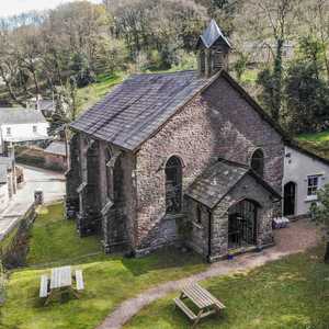
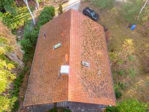
Real estate photography
Nothing shows off a grand house better than a great photo of the whole estate. This has been the limit of drone photography in real estate due to the highly restrictive regulations.
However, since 1st January 2021 this has all changed as the regulation fall in line with the rest of Europe. What does this mean for you? By employing a CAA approved drone operator with the right equipment and qualifications, like Remote Swan, we are able to fly in even the most congested areas to get your aerial photos. In other words, we can take photos of almost any property!
Have confidence that we are trusted by CAA and fully insured with safety being our first priority.
If you would like to find out more, sign up to our mailing list or get in touch.
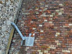
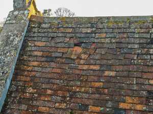
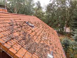
Roof inspections
The dangers of working at height are well known and the HSE advice is to avoid it if at all possible. Using our aircraft, we are able to fly and photograph every section of your roof capturing crisp, high-definition photographs as we go keeping our feet firmly on the ground. No ladders or scaffolding. What this means for you is that within a very short time frame, we can capture a huge amount of data, upload it to our cloud service and generate a 2D and even a 3D map of your roof.
From this we can take very accurate measurements and identify any areas of concern.
We pass the data we collect to our trusted surveyor who will generate a RISC certified report for you so you have information that you can use.
3D modeling of property
We create high resolution 3D models from photographs taken by our drones. These can be a very useful marketing tool, allowing customers to view the property and get a real grip on the building and its immediate surroundings. These are perfect for travel and tourism whether it’s a large hotel or a small holiday let.
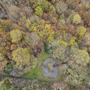
Aerial Mapping
Whether you need to monitor a construction projects progress or map an area ready for a solar installation, we create high resolution orthomosaic maps suitable for your purpose.
Our maps have a high relative accuracy meaning that we can take measurements such as length, area and volume over large areas. We also map elevation data to give you Digital Surface Model (DSM) or even a raw Digital Elevation Model (DEM) of your site.
We can conduct repeatable, automated flights to collect data over a period of time so you can monitor progress.
Our maps typically have a Ground Sample Distance (GSD) of 2.5cm which results in relative accuracies of 5cm horizontally and 7.5cm vertically. Absolute accuracy is currently bound by GPS accuracy, 5m.